History-Rinjani

Mount Rinjani is an active volcano located on the island of Lombok in Indonesia. It is the second-highest volcano in Indonesia, standing at 3,726 meters (12,224 feet) above sea level. The history of Mount Rinjani is deeply intertwined with the geological and cultural history of the region.
Mount Rinjani is part of the Pacific Ring of Fire, an area with a high degree of tectonic activity, including frequent earthquakes and volcanic eruptions. The volcano is situated on the Lombok Island segment of the Sunda Arc, a chain of volcanic islands formed by the subduction of the Indo-Australian Plate beneath the Eurasian Plate.
The area around Mount Rinjani is culturally significant for the Sasak people, who are the predominant ethnic group on Lombok. The volcano and its surroundings are considered sacred, and it holds a special place in Sasak mythology and cultural practices. Local communities often conduct rituals and ceremonies on the slopes of the mountain.
Rinjani has a history of eruptions, with the most recent major eruption occurring in 2010. The eruptions have sometimes resulted in the evacuation of nearby areas and disruptions to local communities. The volcano remains an active concern for monitoring and management due to its potential impact on the surrounding population.
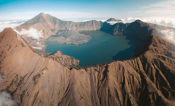
In addition to its geological and cultural significance, Mount Rinjani has become a popular trekking destination. The trek to the summit offers breathtaking views of the crater lake, Segara Anak, and the smaller volcanic cone, Gunung Baru Jari, which emerged in the center of the caldera during a historical eruption. The trek attracts adventure seekers and nature enthusiasts from around the world.
The Rinjani National Park was established in 1997 to help protect the natural and cultural values of the region. The park encompasses not only Mount Rinjani but also the surrounding ecosystems, including forests, wildlife, and traditional land use areas.
